
Chiugiana topographic map
Click on the map to display elevation.
Chiugiana
Chiugiana-La Commenda is a frazione of the comune of Corciano in the Province of Perugia, Umbria, central Italy. It stands at an elevation of 284 metres (932 ft) above sea level. At the time of the Istat census of 2001 it had 6427 inhabitants.
About this map
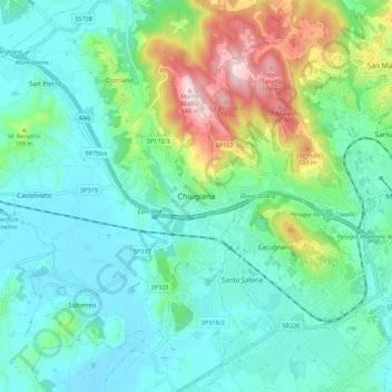
Name: Chiugiana topographic map, elevation, terrain.
Location: Chiugiana, Corciano, Perugia, Umbria, 06073, Italy (43.06532 12.26915 43.14532 12.34915)
Average elevation: 315 m
Minimum elevation: 210 m
Maximum elevation: 647 m