Geolocate

Odenwald topographic map

Click on the map to display elevation.

About this map

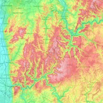
Name: Odenwald topographic map, elevation, terrain.

Location: Odenwald, Hesse, Germany (49.31254 8.61777 49.90398 9.44994)

Average elevation: 302 m

Minimum elevation: 89 m

Maximum elevation: 614 m

Other topographic maps

Click on a map to view its topography, its elevation and its terrain.

Gear up for your next adventure:

🍽️Titanium Camping Spork - Ultralight and indestructible eating utensil
🎒Hiking Daypack - Lightweight and durable backpacks for day trips and excursions
Camping Essentials - All-in-one gear for a comfortable camping trip
🔦LED Headlamp - Hands-free lighting for early morning starts or late finishes
🗺️Topographic Maps - Detailed maps to explore trails, mountains, and wilderness areas

As an Amazon Associate, this site earns from qualifying purchases at no extra cost to you.