
Make a donation
Gear up for your next adventure:
As an Amazon Associate, this site earns from qualifying purchases at no extra cost to you.
Bhuban topographic map
Click on the map to display elevation.
Make a donation
Gear up for your next adventure:
As an Amazon Associate, this site earns from qualifying purchases at no extra cost to you.
Bhuban
Bhuban is located at 20°53′N 85°50′E / 20.88°N 85.83°E / 20.88; 85.83. It has an average elevation of 64 metres (209 feet). As of 2011 India census, Bhuban had a population of 22,200. Males constitute 52% of the population and females 48%. Bhuban has an average literacy rate of 75%, just higher than the national average of 74%; with male literacy of 80.6% and female literacy of 69%. 10.22% of the population is under 6 years of age.
Make a donation
Gear up for your next adventure:
As an Amazon Associate, this site earns from qualifying purchases at no extra cost to you.
About this map
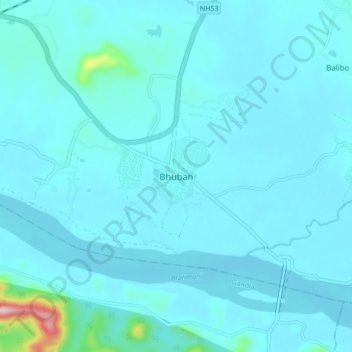
Name: Bhuban topographic map, elevation, terrain.
Location: Bhuban, Dhenkanal, Odisha, 759017, India (20.84220 85.79341 20.92220 85.87341)
Average elevation: 46 m
Minimum elevation: 21 m
Maximum elevation: 362 m
Make a donation
Gear up for your next adventure:
As an Amazon Associate, this site earns from qualifying purchases at no extra cost to you.