Geolocate

Talangan topographic map

Click on the map to display elevation.

About this map

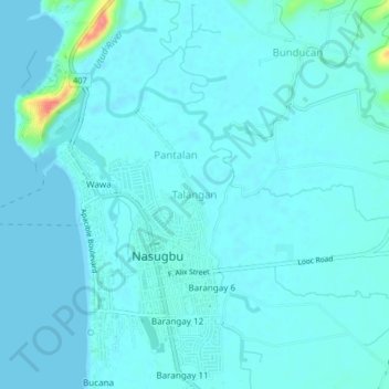
Name: Talangan topographic map, elevation, terrain.

Location: Talangan, Nasugbu, Batangas, Calabarzon, 4231, Philippines (14.05978 120.61617 14.09978 120.65617)

Average elevation: 8 m

Minimum elevation: 0 m

Maximum elevation: 75 m

Other topographic maps

Click on a map to view its topography, its elevation and its terrain.

Talamitam

Philippines > Batangas > Nasugbu > Kayrilaw

Average elevation: 328 m

Gear up for your next adventure:

🦶Hiking Shoe Insoles - Added support for high arches and long days on feet
🥾Trail Hiking Socks - Comfortable socks to prevent blisters and fatigue
💧Hydration Bladder - Hands-free hydration solution for long treks
👟Trail Running Shoes - Agile footwear for fast-paced topographic exploration
🛏️Sleeping Bag - Warm and compact sleeping bags for outdoor camping

As an Amazon Associate, this site earns from qualifying purchases at no extra cost to you.