
Madero topographic map
Interactive map
Click on the map to display elevation.
About this map
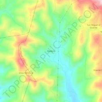
Name: Madero topographic map, elevation, terrain.
Location: Madero, San Miguel el Grande, Oaxaca, México (17.01611 -97.65694 17.05611 -97.61694)
Average elevation: 2,397 m
Minimum elevation: 2,235 m
Maximum elevation: 2,637 m
Other topographic maps
Click on a map to view its topography, its elevation and its terrain.
Ignacio Zaragoza
México > Oaxaca > San Miguel el Grande
Ignacio Zaragoza, San Miguel el Grande, Oaxaca, México
Average elevation: 2,494 m