Geolocate

Mount Morris topographic map

Click on the map to display elevation.

About this map

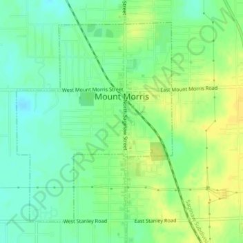
Name: Mount Morris topographic map, elevation, terrain.

Location: Mount Morris, Genesee County, Michigan, 48458, United States (43.10477 -83.71102 43.12689 -83.68726)

Average elevation: 237 m

Minimum elevation: 226 m

Maximum elevation: 247 m

Other topographic maps

Click on a map to view its topography, its elevation and its terrain.

Russellville

United States > Michigan > Genesee County

Average elevation: 233 m

Bayport Park

United States > Michigan > Genesee County

Average elevation: 269 m

Brent Creek

United States > Michigan > Genesee County

Average elevation: 209 m

Duffield

United States > Michigan > Genesee County

Average elevation: 240 m

Farrandville

United States > Michigan > Genesee County

Average elevation: 219 m

Lakeside

United States > Michigan > Genesee County

Average elevation: 268 m

Pine Run

United States > Michigan > Genesee County

Average elevation: 226 m

Rankin

United States > Michigan > Genesee County

Average elevation: 251 m

Rogersville

United States > Michigan > Genesee County

Average elevation: 232 m

Atlas

United States > Michigan > Genesee County

Average elevation: 262 m

Otter Lake

United States > Michigan > Genesee County

Average elevation: 263 m

Seely Lake

United States > Michigan > Genesee County

Average elevation: 263 m

Gear up for your next adventure:

🧭GPS Handheld Device - Reliable GPS navigation for outdoor adventures
🧴Insect Repellent - Protect yourself from bugs during outdoor adventures
🧥Packable Rain Jacket - Breathable waterproof layer for unpredictable weather
👖Convertible Hiking Pants - Zip-off legs to adapt to changing weather conditions
🚑Survival Whistle - Signal for help across long distances in mountains

As an Amazon Associate, this site earns from qualifying purchases at no extra cost to you.