
Salvatierra de Esca topographic map
Interactive map
Click on the map to display elevation.
About this map
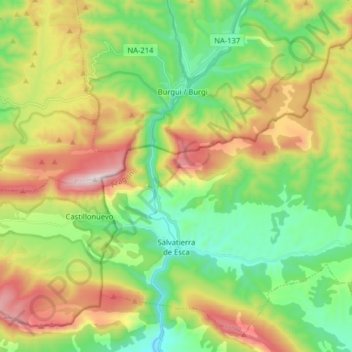
Name: Salvatierra de Esca topographic map, elevation, terrain.
Location: Salvatierra de Esca, La Jacetania, Zaragoza, Aragón, Spanje (42.63927 -1.03952 42.74413 -0.87995)
Average elevation: 844 m
Minimum elevation: 507 m
Maximum elevation: 1,408 m
Other topographic maps
Click on a map to view its topography, its elevation and its terrain.
Canfranc
Spanje > Aragón > La Jacetania
Canfranc, La Jacetania, Huesca, Aragón, 22880, Spanje
Average elevation: 1,928 m
Jaca
Spanje > Aragón > La Jacetania
Jaca, La Jacetania, Huesca, Aragón, Spanje
Average elevation: 1,223 m