
Thank you for supporting this site ❤️
Make a donation
Make a donation
Gear up for your next adventure:
As an Amazon Associate, this site earns from qualifying purchases at no extra cost to you.
Njeguši topographic map
Click on the map to display elevation.
Thank you for supporting this site ❤️
Make a donation
Make a donation
Gear up for your next adventure:
As an Amazon Associate, this site earns from qualifying purchases at no extra cost to you.
About this map
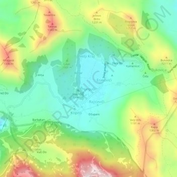
Name: Njeguši topographic map, elevation, terrain.
Location: Njeguši, Old Royal Capital Cetinje, Montenegro (42.41130 18.80477 42.45130 18.84477)
Average elevation: 1,057 m
Minimum elevation: 809 m
Maximum elevation: 1,471 m
Thank you for supporting this site ❤️
Make a donation
Make a donation
Gear up for your next adventure:
As an Amazon Associate, this site earns from qualifying purchases at no extra cost to you.