Geolocate

Saint-Prosper topographic map

Click on the map to display elevation.

About this map
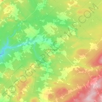
Name: Saint-Prosper topographic map, elevation, terrain.

Location: Saint-Prosper, Les Etchemins, Chaudière-Appalaches, Québec, G0M 1Y0, Canada (46.14435 -70.58844 46.27515 -70.37224)

Average elevation: 338 m

Minimum elevation: 223 m

Maximum elevation: 505 m

Other topographic maps

Click on a map to view its topography, its elevation and its terrain.

Ménard

Canada > Québec > Les Etchemins > Saint-Magloire

Average elevation: 442 m

Mont Orignal

Canada > Québec > Les Etchemins > Lac-Etchemin

Average elevation: 418 m

Gear up for your next adventure:

🧊Insulated Water Bottle - Keeps drinks cold in summer and prevents freezing in winter
🥾All-Terrain Hiking Boots - Versatile boots for varied hiking conditions
🧣Evaporative Cooling Towel - Beat the heat during intense summer climbs
🦶Hiking Shoe Insoles - Added support for high arches and long days on feet
🚲Bike Repair Kit - Essential tools for on-trail mechanical issues

As an Amazon Associate, this site earns from qualifying purchases at no extra cost to you.