Geolocate

Landugan topographic map

Click on the map to display elevation.

About this map

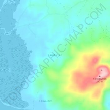
Name: Landugan topographic map, elevation, terrain.

Location: Landugan, Lantawan, Basilan, Bangsamoro, Philippines (6.59600 121.79691 6.63600 121.83691)

Average elevation: 45 m

Minimum elevation: -1 m

Maximum elevation: 212 m

Gear up for your next adventure:

🥫Freeze-Dried Meals - Lightweight, high-calorie nutrition for multi-day treks
Lightweight Camping Tent - Portable shelter optimized for Canadian backcountry camping
🧰Emergency Multi-Tool - Compact multi-tool for outdoor survival
🔥Emergency Fire Starter - Reliable ignition source for all weather conditions
🔭Compact Monocular - One-handed bird watching and trail spotting

As an Amazon Associate, this site earns from qualifying purchases at no extra cost to you.