Geolocate

Rockport topographic map

Click on the map to display elevation.

About this map

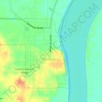
Name: Rockport topographic map, elevation, terrain.

Location: Rockport, Spencer County, Indiana, United States (37.87542 -87.07115 37.89515 -87.04306)

Average elevation: 121 m

Minimum elevation: 104 m

Maximum elevation: 151 m

Gear up for your next adventure:

🧰Multitool Knife - Compact and versatile tool for outdoor use
👟Leg Gaiters - Keep debris, mud, and snow out of your boots
🥾Approach Boots - Comfortable boots for hiking and climbing approaches
🦶Hiking Shoe Insoles - Added support for high arches and long days on feet
🔋Lithium AA Batteries - Long-lasting power that performs in extreme cold

As an Amazon Associate, this site earns from qualifying purchases at no extra cost to you.