Geolocate

Rye Cove topographic map

Click on the map to display elevation.

About this map

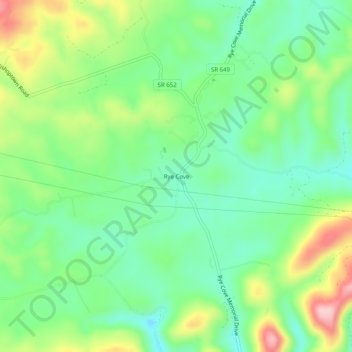
Name: Rye Cove topographic map, elevation, terrain.

Location: Rye Cove, Scott County, Virginia, United States (36.70538 -82.71627 36.74538 -82.67627)

Average elevation: 475 m

Minimum elevation: 404 m

Maximum elevation: 608 m

Other topographic maps

Click on a map to view its topography, its elevation and its terrain.

Duffield

United States > Virginia > Scott County

Average elevation: 457 m

Duffield

United States > Virginia > Scott County

Average elevation: 457 m

Gate City

United States > Virginia > Scott County

Average elevation: 488 m

Gear up for your next adventure:

🥾Lightweight Hiking Shoes - Comfortable shoes for day hikes
🧢Beanie Hat - Keep your head warm in cold weather
🏕️Camping Hammock - Integrated protection for sleeping between trees
🥾Waterproof Hiking Boots - Essential footwear for rugged terrain and wet Canadian trails
🔦LED Headlamp - Hands-free lighting for early morning starts or late finishes

As an Amazon Associate, this site earns from qualifying purchases at no extra cost to you.