
Boden topographic map
Click on the map to display elevation.
About this map
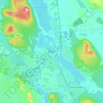
Name: Boden topographic map, elevation, terrain.
Location: Boden, Bodens kommun, Norrbotten County, 961 61, Sweden (65.78750 21.65641 65.86750 21.73641)
Average elevation: 31 m
Minimum elevation: 4 m
Maximum elevation: 170 m
Other topographic maps
Click on a map to view its topography, its elevation and its terrain.
Torneträsk
Permafrost is common in the land around the lake. This low elevation permafrost is disappearing because of global warming and increased snowfall.
Average elevation: 768 m
Abisko National Park
Permafrost is common in the national park, though permafrost at lower elevations is disappearing because of global warming and increased snowfall.
Average elevation: 740 m