Geolocate

Beas River topographic map

Click on the map to display elevation.

About this map

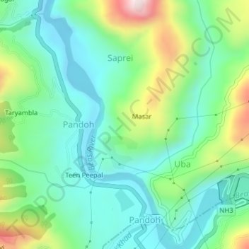
Name: Beas River topographic map, elevation, terrain.

Location: Beas River, Pandoh, Mandi, Himachal Pradesh, 175124, India (31.66544 77.04320 31.69261 77.06479)

Average elevation: 962 m

Minimum elevation: 820 m

Maximum elevation: 1,310 m

Gear up for your next adventure:

🌬️Windproof Camp Stove - Efficient cooking even on exposed mountain peaks
🛏️Sleeping Bag - Warm and compact sleeping bags for outdoor camping
💧Collapsible Water Bottle - Space-saving water bottle for outdoor activities
🔪Outdoor Multitool - Versatile tool for repairs and food prep in the wild
🧼Travel Hand Sanitizer - Keep hands clean when water is scarce

As an Amazon Associate, this site earns from qualifying purchases at no extra cost to you.