
Thank you for supporting this site ❤️
Make a donation
Make a donation
Gear up for your next adventure:
As an Amazon Associate, this site earns from qualifying purchases at no extra cost to you.
Al-Qantara Gharb topographic map
Click on the map to display elevation.
Thank you for supporting this site ❤️
Make a donation
Make a donation
Gear up for your next adventure:
As an Amazon Associate, this site earns from qualifying purchases at no extra cost to you.
About this map
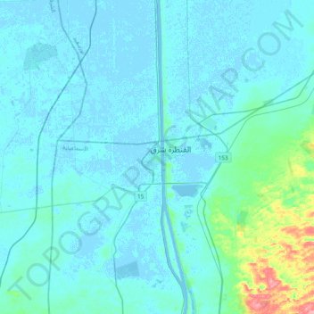
Name: Al-Qantara Gharb topographic map, elevation, terrain.
Location: Al-Qantara Gharb, Ismailia, 41524, Egypt (30.69509 32.14961 31.01509 32.46961)
Average elevation: 8 m
Minimum elevation: -4 m
Maximum elevation: 92 m
Thank you for supporting this site ❤️
Make a donation
Make a donation
Gear up for your next adventure:
As an Amazon Associate, this site earns from qualifying purchases at no extra cost to you.