Geolocate

Paradise topographic map

Click on the map to display elevation.

About this map

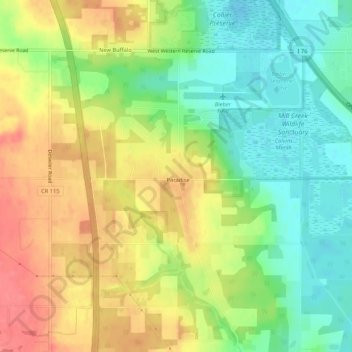
Name: Paradise topographic map, elevation, terrain.

Location: Paradise, Mahoning County, Ohio, 44452, United States (40.95378 -80.72730 40.99378 -80.68730)

Average elevation: 334 m

Minimum elevation: 301 m

Maximum elevation: 370 m

Gear up for your next adventure:

🥾Mountain Trail Shoes - High-traction shoes for mountain trails
🛌Insulated Sleeping Pad - Critical thermal barrier between you and the cold ground
🧰Survival Kit - Essential gear for emergencies in the wilderness
🧣Evaporative Cooling Towel - Beat the heat during intense summer climbs
🧴Insect Repellent - Protect yourself from bugs during outdoor adventures

As an Amazon Associate, this site earns from qualifying purchases at no extra cost to you.