Geolocate

nagar topographic map

Click on the map to display elevation.

About this map

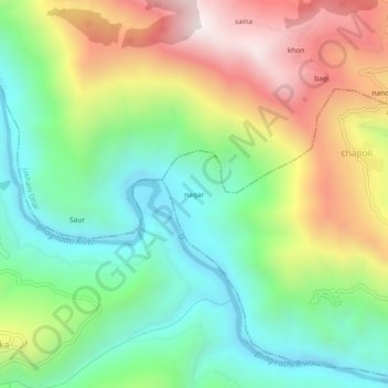
Name: nagar topographic map, elevation, terrain.

Location: nagar, Devprayag, Tehri Garhwal, Uttarakhand, 249146, India (30.23259 78.51064 30.27259 78.55064)

Average elevation: 945 m

Minimum elevation: 510 m

Maximum elevation: 1,626 m

Gear up for your next adventure:

👟Sport Hiking Sandals - Breathable footwear for water crossings and camp rest
🧦Outdoor Socks - Durable socks designed for hiking and outdoor sports
🛌Insulated Sleeping Pad - Critical thermal barrier between you and the cold ground
💧Hydration Pack - Hands-free hydration system for long hikes
Lightweight Camping Tent - Portable shelter optimized for Canadian backcountry camping

As an Amazon Associate, this site earns from qualifying purchases at no extra cost to you.