Geolocate

Lucsuhin topographic map

Click on the map to display elevation.

About this map

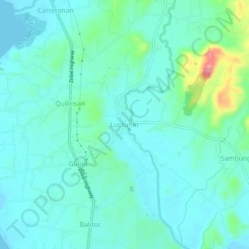
Name: Lucsuhin topographic map, elevation, terrain.

Location: Lucsuhin, Calatagan, Batangas, Calabarzon, Philippines (13.86129 120.62156 13.90129 120.66156)

Average elevation: 24 m

Minimum elevation: -1 m

Maximum elevation: 132 m

Other topographic maps

Click on a map to view its topography, its elevation and its terrain.

Burot Beach

Philippines > Batangas > Calatagan

Average elevation: 3 m

Pagapas Bay

Philippines > Batangas > Calatagan

Average elevation: 15 m

Gear up for your next adventure:

🥾Approach Shoes - Shoes designed for climbing approaches and rugged trails
🛶Kayak Dry Bag - Waterproof storage for kayaking adventures
🥾Waterproof Hiking Boots - Essential footwear for rugged terrain and wet Canadian trails
🛶Canoe Life Vest - Safety vest for water sports
🛶Waterproof Dry Bags - Keep electronics and clothes dry during river crossings

As an Amazon Associate, this site earns from qualifying purchases at no extra cost to you.