Geolocate

Eramosa topographic map

Click on the map to display elevation.

About this map
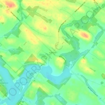
Name: Eramosa topographic map, elevation, terrain.

Location: Eramosa, Guelph/Eramosa, Wellington County, Ontario, N1E 0G1, Canada (43.59740 -80.23647 43.63740 -80.19647)

Average elevation: 361 m

Minimum elevation: 342 m

Maximum elevation: 387 m

Wellington County trails, hiking, mountain biking, running and outdoor activities

Other topographic maps

Click on a map to view its topography, its elevation and its terrain.

Gear up for your next adventure:

🥾Trail Running Boots - Durable shoes designed for trail running
🕯️Camping Lantern - Illuminates your entire campsite with high-efficiency LEDs
🥫Freeze-Dried Meals - Lightweight, high-calorie nutrition for multi-day treks
🧢Hiking Sun Hat - Wide-brimmed protection for exposed mountain ridges
🧤Insulated Winter Gloves - Heavy-duty protection for sub-zero Canadian adventures

As an Amazon Associate, this site earns from qualifying purchases at no extra cost to you.