
Travilah topographic map
Click on the map to display elevation.
Travilah
The United States Geological Survey lists six features in Montgomery County with Travilah in all or part of their name. The Travilah Census Designated Place has an ID of 2390400 and an elevation of 233 feet. It has a latitude of 390325N and a longitude of 0771445W—a location of 39°3′25″N 77°14′45″W / 39.05694°N 77.24583°W / 39.05694; -77.24583. The feature named Travilah, different from the Travilah Census Designated Place, is a populated place and has an elevation of 358 with a latitude of 390457N and a longitude of 0771547W. Other features listed are Travilah Acres, Travilah Elementary School, Travilah Meadows, and Travilah Square Shopping Center.
About this map
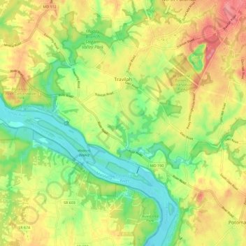
Name: Travilah topographic map, elevation, terrain.
Location: Travilah, Montgomery County, Maryland, United States (39.02052 -77.29871 39.08645 -77.18511)
Average elevation: 96 m
Minimum elevation: 43 m
Maximum elevation: 157 m