Geolocate

Pachad topographic map

Click on the map to display elevation.

About this map
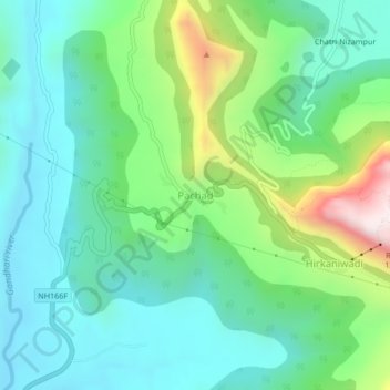
Name: Pachad topographic map, elevation, terrain.

Location: Pachad, Mahad, Raigad, Maharashtra, 402305, India (18.21656 73.40061 18.25656 73.44061)

Average elevation: 248 m

Minimum elevation: 27 m

Maximum elevation: 858 m

Other topographic maps

Click on a map to view its topography, its elevation and its terrain.

Raigad Fort

India > Maharashtra > Mahad > Hirkaniwadi

Average elevation: 450 m

Gear up for your next adventure:

🥾Mountain Trail Shoes - High-traction shoes for mountain trails
🧭GPS Handheld Device - Reliable GPS navigation for outdoor adventures
⛺Lightweight Camping Tent - Portable shelter optimized for Canadian backcountry camping
🛌Down Sleeping Bag - Superior warmth-to-weight ratio for cold nights
🛶Canoe Life Vest - Safety vest for water sports

As an Amazon Associate, this site earns from qualifying purchases at no extra cost to you.