
Pfeifferberg topographic map
Interactive map
Click on the map to display elevation.
About this map
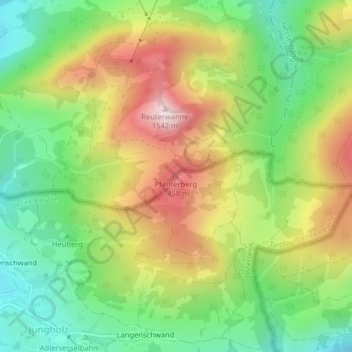
Name: Pfeifferberg topographic map, elevation, terrain.
Location: Pfeifferberg, Jungholz, Bezirk Reutte, Tyrol, 6691, Autriche (47.58520 10.46145 47.58530 10.46155)
Average elevation: 1,227 m
Minimum elevation: 1,000 m
Maximum elevation: 1,530 m