
祁县 topographic map
Interactive map
Click on the map to display elevation.
About this map
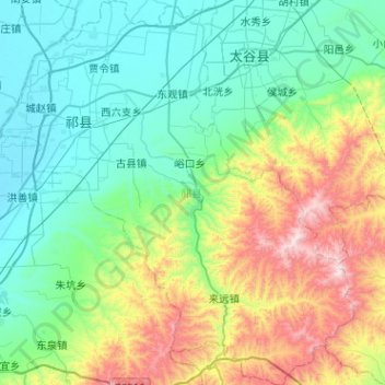
Name: 祁县 topographic map, elevation, terrain.
Location: 祁县, 晋中市, 山西省, 中国 (37.07900 112.21532 37.48414 112.68231)
Average elevation: 1,050 m
Minimum elevation: 744 m
Maximum elevation: 1,991 m
Other topographic maps
Click on a map to view its topography, its elevation and its terrain.