
Agua Señora topographic map
Interactive map
Click on the map to display elevation.
About this map
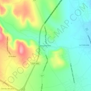
Name: Agua Señora topographic map, elevation, terrain.
Location: Agua Señora, Mexquitic de Carmona, San Luis Potosi, Mexico (22.21871 -101.06244 22.25871 -101.02244)
Average elevation: 1,931 m
Minimum elevation: 1,881 m
Maximum elevation: 2,018 m