Geolocate

Princess Urduja topographic map

Click on the map to display elevation.

About this map

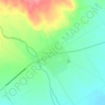
Name: Princess Urduja topographic map, elevation, terrain.

Location: Princess Urduja, Narra, Palawan, Mimaropa, Philippines (9.20977 118.30941 9.24977 118.34941)

Average elevation: 48 m

Minimum elevation: 15 m

Maximum elevation: 111 m

Gear up for your next adventure:

🧢Beanie Hat - Keep your head warm in cold weather
🧭GPS Tracker - Track your location in remote areas safely
🥾Hiking Shorts - Breathable shorts suitable for summer hikes
👟Sport Hiking Sandals - Breathable footwear for water crossings and camp rest
🥾Trekking Boots - Durable boots for long-distance trekking

As an Amazon Associate, this site earns from qualifying purchases at no extra cost to you.