
Thank you for supporting this site ❤️
Make a donation
Make a donation
Gear up for your next adventure:
As an Amazon Associate, this site earns from qualifying purchases at no extra cost to you.
Malindi topographic map
Click on the map to display elevation.
Thank you for supporting this site ❤️
Make a donation
Make a donation
Gear up for your next adventure:
As an Amazon Associate, this site earns from qualifying purchases at no extra cost to you.
About this map
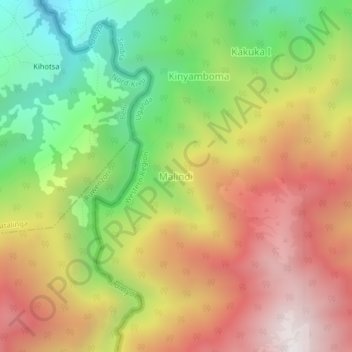
Name: Malindi topographic map, elevation, terrain.
Location: Malindi, Sindila, Bundibugyo, Western Region, Uganda (0.52607 29.96488 0.56607 30.00488)
Average elevation: 2,227 m
Minimum elevation: 1,478 m
Maximum elevation: 2,979 m
Thank you for supporting this site ❤️
Make a donation
Make a donation
Gear up for your next adventure:
As an Amazon Associate, this site earns from qualifying purchases at no extra cost to you.