Geolocate

Cochamarca topographic map

Click on the map to display elevation.

About this map

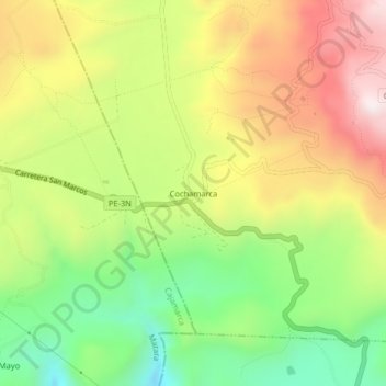
Name: Cochamarca topographic map, elevation, terrain.

Location: Cochamarca, Gregorio Pita, San Marcos, Cajamarca, Perú (-7.30199 -78.23661 -7.26199 -78.19661)

Average elevation: 2,851 m

Minimum elevation: 2,507 m

Maximum elevation: 3,236 m

Gear up for your next adventure:

🧥Softshell Jacket - Windproof and breathable jacket for hiking
🌡️Emergency Mylar Blankets - Compact thermal protection for unexpected nights outdoors
👟Trail Running Shoes - Agile footwear for fast-paced topographic exploration
🧰Survival Kit - Essential gear for emergencies in the wilderness
🥾Waterproof Hiking Shoes - Durable shoes for wet and rugged trails

As an Amazon Associate, this site earns from qualifying purchases at no extra cost to you.