Geolocate

Kasarsai topographic map

Click on the map to display elevation.

About this map

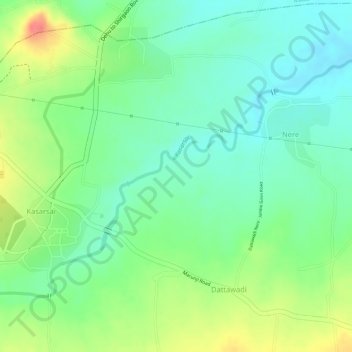
Name: Kasarsai topographic map, elevation, terrain.

Location: Kasarsai, Nere, Mulshi, Maharashtra, 412101, India (18.62388 73.67752 18.63708 73.69648)

Average elevation: 605 m

Minimum elevation: 578 m

Maximum elevation: 647 m

Gear up for your next adventure:

🧰Emergency Multi-Tool - Compact multi-tool for outdoor survival
🚲Heavy Duty Bike Lock - Secure your bike at the trailhead or during stops
🧤Thermal Hiking Gloves - Grip-enhanced gloves for cold-weather altitude trekking
🧦Hiking Liner Socks - Thin base layer to prevent friction and blisters
👟Trail Running Shoes - Agile footwear for fast-paced topographic exploration

As an Amazon Associate, this site earns from qualifying purchases at no extra cost to you.