
Thank you for supporting this site ❤️
Make a donation
Make a donation
Gear up for your next adventure:
As an Amazon Associate, this site earns from qualifying purchases at no extra cost to you.
Yaylalar topographic map
Click on the map to display elevation.
Thank you for supporting this site ❤️
Make a donation
Make a donation
Gear up for your next adventure:
As an Amazon Associate, this site earns from qualifying purchases at no extra cost to you.
About this map
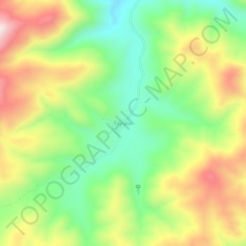
Name: Yaylalar topographic map, elevation, terrain.
Location: Yaylalar, Bayburt, Black Sea Region, Turkey (40.03964 40.20608 40.07964 40.24608)
Average elevation: 2,234 m
Minimum elevation: 1,998 m
Maximum elevation: 2,543 m
Thank you for supporting this site ❤️
Make a donation
Make a donation
Gear up for your next adventure:
As an Amazon Associate, this site earns from qualifying purchases at no extra cost to you.