Geolocate

Karben topographic map

Click on the map to display elevation.

About this map

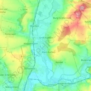
Name: Karben topographic map, elevation, terrain.

Location: Karben, Wetteraukreis, Hesse, 61184, Germany (50.19448 8.68845 50.26796 8.82727)

Average elevation: 141 m

Minimum elevation: 105 m

Maximum elevation: 220 m

Gear up for your next adventure:

🔥Emergency Fire Starter - Reliable ignition source for all weather conditions
🧼Travel Hand Sanitizer - Keep hands clean when water is scarce
👟Leg Gaiters - Keep debris, mud, and snow out of your boots
🛶Canoe Life Vest - Safety vest for water sports
🧰Emergency Multi-Tool - Compact multi-tool for outdoor survival

As an Amazon Associate, this site earns from qualifying purchases at no extra cost to you.