
Lorwall Lake topographic map
Click on the map to display elevation.
About this map
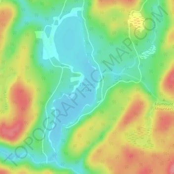
Name: Lorwall Lake topographic map, elevation, terrain.
Average elevation: 401 m
Minimum elevation: 364 m
Maximum elevation: 453 m
Renfrew County trails, hiking, mountain biking, running and outdoor activities
Other topographic maps
Click on a map to view its topography, its elevation and its terrain.
Palmer Rapids
Canada > Ontario > Renfrew County > Brudenell, Lyndoch and Raglan
Average elevation: 319 m
Raglan White Lake
Canada > Ontario > Renfrew County > Brudenell, Lyndoch and Raglan
Average elevation: 324 m