Geolocate

Nabha topographic map

Click on the map to display elevation.

Nabha

Nabha is located at 30°22′N 76°09′E / 30.37°N 76.15°E / 30.37; 76.15. It has an average elevation of 246 metres (807 feet).

Wikipedia (CC-BY-SA 3.0)

About this map

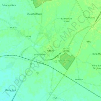
Name: Nabha topographic map, elevation, terrain.

Location: Nabha, Nabha Tahsil, Patiala District, Punjab, 147201, India (30.33399 76.11287 30.41399 76.19287)

Average elevation: 251 m

Minimum elevation: 246 m

Maximum elevation: 255 m

Gear up for your next adventure:

🚲Heavy Duty Bike Lock - Secure your bike at the trailhead or during stops
🔦LED Headlamp - Hands-free lighting for early morning starts or late finishes
🔪Outdoor Multitool - Versatile tool for repairs and food prep in the wild
🏕️Camping Hammock - Integrated protection for sleeping between trees
👟Sport Hiking Sandals - Breathable footwear for water crossings and camp rest

As an Amazon Associate, this site earns from qualifying purchases at no extra cost to you.