
Rennesøy topographic map
Interactive map
Click on the map to display elevation.
About this map
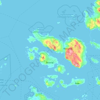
Name: Rennesøy topographic map, elevation, terrain.
Location: Rennesøy, Stavanger, Rogaland, Noorwegen (59.01449 5.49903 59.19042 5.86177)
Average elevation: 10 m
Minimum elevation: -1 m
Maximum elevation: 214 m