Geolocate

Castelnaud topographic map

Click on the map to display elevation.

About this map
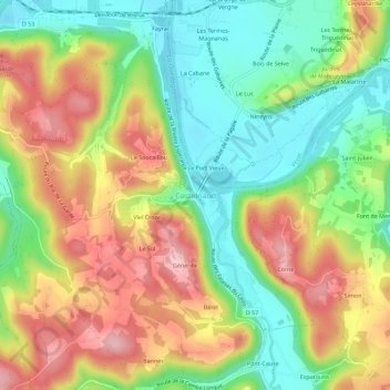
Name: Castelnaud topographic map, elevation, terrain.

Location: Castelnaud, Castelnaud-la-Chapelle, Sarlat-la-Canéda, Dordogne, Nouvelle-Aquitaine, France métropolitaine, 24250, France (44.79380 1.13120 44.83380 1.17120)

Average elevation: 144 m

Minimum elevation: 58 m

Maximum elevation: 246 m

Other topographic maps

Click on a map to view its topography, its elevation and its terrain.

Gear up for your next adventure:

🥾Trail Running Shoes - Lightweight and durable shoes for trail running
🛌Insulated Sleeping Pad - Critical thermal barrier between you and the cold ground
🧥Waterproof Hiking Jacket - Protect yourself from rain and wind while hiking
🧊Insulated Water Bottle - Keeps drinks cold in summer and prevents freezing in winter
🔪Outdoor Multitool - Versatile tool for repairs and food prep in the wild

As an Amazon Associate, this site earns from qualifying purchases at no extra cost to you.