
Pillayarpatti topographic map
Click on the map to display elevation.
About this map
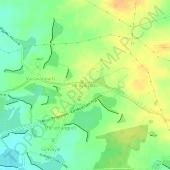
Name: Pillayarpatti topographic map, elevation, terrain.
Average elevation: 107 m
Minimum elevation: 90 m
Maximum elevation: 124 m
Other topographic maps
Click on a map to view its topography, its elevation and its terrain.
Tiruppattur
India > Tamil Nadu > Thiruppathur
Tirupathur is called "Sandalwood Town" due to the abundance of sandalwood trees in the surrounding hills. It is very close to the Yelagiri hills, a major hill station of Tamil Nadu. The town is at an average elevation of 388 m (1,273 ft). The Jawadhu Hills, a part of the eastern ghats, are to the east of…
Average elevation: 96 m