Geolocate

Lechința topographic map

Click on the map to display elevation.

About this map

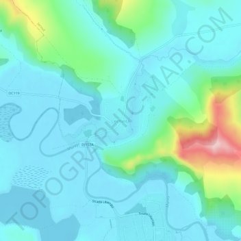
Name: Lechința topographic map, elevation, terrain.

Location: Lechința, Iernut, Mureș, 545103, Romania (46.45376 24.20654 46.49376 24.24654)

Average elevation: 313 m

Minimum elevation: 275 m

Maximum elevation: 489 m

Other topographic maps

Click on a map to view its topography, its elevation and its terrain.

Oarba de Mureș

Romania > Mureș > Iernut

Average elevation: 331 m

Gear up for your next adventure:

🥾Lightweight Hiking Boots - Boots for comfort and mobility on long hikes
👖Convertible Hiking Pants - Zip-off legs to adapt to changing weather conditions
🛶Kayak Accessories - Essential gear for safe and fun kayaking adventures
🛌Down Sleeping Bag - Superior warmth-to-weight ratio for cold nights
🪑Insulated Seat Pad - Protect your seat from cold rocks and wet logs

As an Amazon Associate, this site earns from qualifying purchases at no extra cost to you.