Geolocate

Powhattan topographic map

Click on the map to display elevation.

About this map

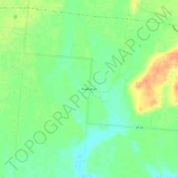
Name: Powhattan topographic map, elevation, terrain.

Location: Powhattan, Champaign County, Ohio, United States (40.02228 -83.70993 40.06228 -83.66993)

Average elevation: 339 m

Minimum elevation: 321 m

Maximum elevation: 363 m

Other topographic maps

Click on a map to view its topography, its elevation and its terrain.

North Lewisburg

United States > Ohio > Champaign County

Average elevation: 335 m

Woodstock

United States > Ohio > Champaign County

Average elevation: 320 m

Mutual

United States > Ohio > Champaign County

Average elevation: 367 m

Mechanicsburg

United States > Ohio > Champaign County

Average elevation: 332 m

Mad River

United States > Ohio > Champaign County > West Liberty

Average elevation: 337 m

St. Paris

United States > Ohio > Champaign County

Average elevation: 373 m

Christiansburg

United States > Ohio > Champaign County

Average elevation: 342 m

Gear up for your next adventure:

🥾Mountain Hiking Shoes - Shoes with superior grip for mountainous terrain
🧦Thermal Socks - Warm socks for winter hiking or camping
🔭Compact Monocular - One-handed bird watching and trail spotting
👟Trail Running Shoes - Agile footwear for fast-paced topographic exploration
💡LED Headlamp - Hands-free illumination for night hiking and camping

As an Amazon Associate, this site earns from qualifying purchases at no extra cost to you.