Geolocate

Adri topographic map

Click on the map to display elevation.

About this map

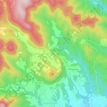
Name: Adri topographic map, elevation, terrain.

Location: Adri, Canet d'Adri, Gironés, Gerona, Cataluña, 17199, España (42.03174 2.71915 42.07174 2.75915)

Average elevation: 311 m

Minimum elevation: 160 m

Maximum elevation: 523 m

Gear up for your next adventure:

🧰Survival Kit - Essential gear for emergencies in the wilderness
🦯Trekking Poles - Reduced impact on joints for steep topographic climbs
🥾Lightweight Hiking Boots - Boots for comfort and mobility on long hikes
🧢Outdoor Visor - Breathable visor for sunny hikes
👟Sport Hiking Sandals - Breathable footwear for water crossings and camp rest

As an Amazon Associate, this site earns from qualifying purchases at no extra cost to you.