Geolocate

Botany topographic map

Click on the map to display elevation.

About this map
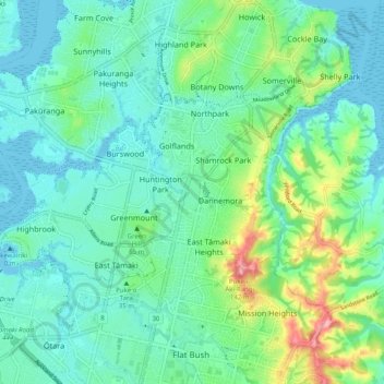
Name: Botany topographic map, elevation, terrain.

Location: Botany, Howick, Auckland, 2163, New Zealand (-36.97213 174.87302 -36.89213 174.95302)

Average elevation: 32 m

Minimum elevation: 0 m

Maximum elevation: 139 m

Other topographic maps

Click on a map to view its topography, its elevation and its terrain.

Stevenson Reserve

New Zealand > Auckland > Howick

Average elevation: 38 m

Gear up for your next adventure:

📷Outdoor Action Camera - Capture high-elevation views and rugged adventures
❄️Traction Ice Cleats - Slip-on spikes for icy trails and winter hiking
🏃Hydration Running Vest - Carry water and maps close to your body for speed
🦶Anti-Blister Balm - Prevents friction and hotspots during long ascents
🕯️Camping Lantern - Illuminates your entire campsite with high-efficiency LEDs

As an Amazon Associate, this site earns from qualifying purchases at no extra cost to you.