Geolocate

Kumarakom topographic map

Click on the map to display elevation.

About this map

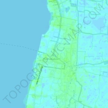
Name: Kumarakom topographic map, elevation, terrain.

Location: Kumarakom, Kottayam, Kerala, 686563, India (9.57678 76.41113 9.61678 76.45113)

Average elevation: 2 m

Minimum elevation: -4 m

Maximum elevation: 8 m

Gear up for your next adventure:

🔨Vehicle Emergency Tool - Safety tool for remote road trips to trailheads
🥘Camping Cookware Set - Compact nesting pots and pans for trail cooking
🎒Hiking Backpack - Lightweight and ergonomic backpacks for day hikes or multi-day treks
🧦Hiking Socks - Moisture-wicking and comfortable socks for long hikes
🥾Hiking Gaiters - Protect legs and shoes from mud, snow, and debris

As an Amazon Associate, this site earns from qualifying purchases at no extra cost to you.