Geolocate

Le Grazie topographic map

Click on the map to display elevation.

About this map

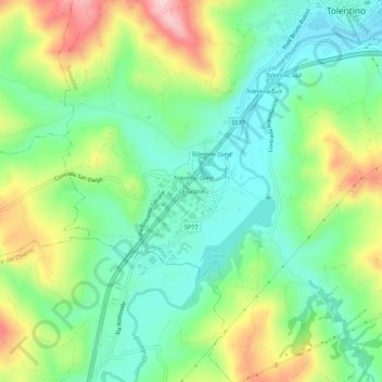
Name: Le Grazie topographic map, elevation, terrain.

Location: Le Grazie, Tolentino, Macerata, Marche, 62029, Italy (43.16984 13.24217 43.20984 13.28217)

Average elevation: 286 m

Minimum elevation: 194 m

Maximum elevation: 459 m

Gear up for your next adventure:

👟Sport Hiking Sandals - Breathable footwear for water crossings and camp rest
Lightweight Backpacking Tent - Compact tent for efficient hiking trips
🕶️Polarized Sunglasses - Reduces glare from snow and water at high elevations
🧥Packable Rain Jacket - Breathable waterproof layer for unpredictable weather
🧢Hiking Sun Hat - Wide-brimmed protection for exposed mountain ridges

As an Amazon Associate, this site earns from qualifying purchases at no extra cost to you.