
Thank you for supporting this site ❤️
Make a donation
Make a donation
Gear up for your next adventure:
As an Amazon Associate, this site earns from qualifying purchases at no extra cost to you.
Kadampuliyur topographic map
Click on the map to display elevation.
Thank you for supporting this site ❤️
Make a donation
Make a donation
Gear up for your next adventure:
As an Amazon Associate, this site earns from qualifying purchases at no extra cost to you.
About this map
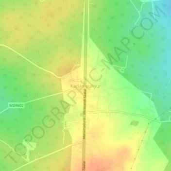
Name: Kadampuliyur topographic map, elevation, terrain.
Location: Kadampuliyur, Panruti, Cuddalore, Tamil Nadu, 607103, India (11.68135 79.53118 11.72135 79.57118)
Average elevation: 70 m
Minimum elevation: 48 m
Maximum elevation: 87 m
Thank you for supporting this site ❤️
Make a donation
Make a donation
Gear up for your next adventure:
As an Amazon Associate, this site earns from qualifying purchases at no extra cost to you.