
Thank you for supporting this site ❤️
Make a donation
Make a donation
Gear up for your next adventure:
As an Amazon Associate, this site earns from qualifying purchases at no extra cost to you.
Tschirgant topographic map
Click on the map to display elevation.
Thank you for supporting this site ❤️
Make a donation
Make a donation
Gear up for your next adventure:
As an Amazon Associate, this site earns from qualifying purchases at no extra cost to you.
About this map
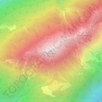
Name: Tschirgant topographic map, elevation, terrain.
Location: Tschirgant, Karres, Bezirk Imst, Tyrol, 6462, Austria (47.24164 10.79634 47.24174 10.79644)
Average elevation: 1,692 m
Minimum elevation: 819 m
Maximum elevation: 2,355 m
Thank you for supporting this site ❤️
Make a donation
Make a donation
Gear up for your next adventure:
As an Amazon Associate, this site earns from qualifying purchases at no extra cost to you.