Geolocate

Jesús María topographic map

Click on the map to display elevation.

About this map

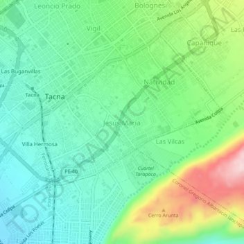
Name: Jesús María topographic map, elevation, terrain.

Location: Jesús María, Tacna, Provincia de Tacna, Tacna, 23003, Perú (-18.03806 -70.25949 -17.99806 -70.21949)

Average elevation: 606 m

Minimum elevation: 510 m

Maximum elevation: 827 m

Gear up for your next adventure:

🧭GPS Handheld Device - Reliable GPS navigation for outdoor adventures
💧Hydration Pack - Hands-free hydration system for long hikes
🦯Trekking Poles - Reduced impact on joints for steep topographic climbs
🔥Emergency Fire Starter - Reliable ignition source for all weather conditions
🧰Emergency Multi-Tool - Compact multi-tool for outdoor survival

As an Amazon Associate, this site earns from qualifying purchases at no extra cost to you.