Geolocate

Huaca Colorada topographic map

Click on the map to display elevation.

About this map

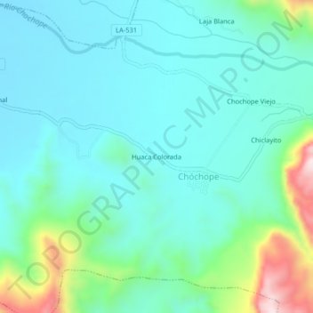
Name: Huaca Colorada topographic map, elevation, terrain.

Location: Huaca Colorada, Chóchope, Lambayeque, Perú (-6.17530 -79.67342 -6.13530 -79.63342)

Average elevation: 252 m

Minimum elevation: 153 m

Maximum elevation: 632 m

Gear up for your next adventure:

📷Outdoor Action Camera - Capture high-elevation views and rugged adventures
🧼Biodegradable Camp Soap - Environmentally friendly cleaning for gear and body
❄️Traction Ice Cleats - Slip-on spikes for icy trails and winter hiking
🥾Approach Boots - Comfortable boots for hiking and climbing approaches
👟Sport Hiking Sandals - Breathable footwear for water crossings and camp rest

As an Amazon Associate, this site earns from qualifying purchases at no extra cost to you.