Geolocate

Pariyaram topographic map

Click on the map to display elevation.

About this map

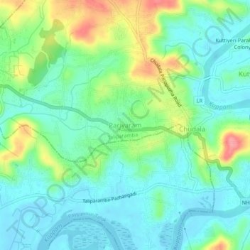
Name: Pariyaram topographic map, elevation, terrain.

Location: Pariyaram, Taliparamba, Kannur district, Kerala, 670502, India (12.04194 75.30515 12.08194 75.34515)

Average elevation: 27 m

Minimum elevation: -1 m

Maximum elevation: 92 m

Gear up for your next adventure:

🧴Waterproofing Spray - Restore the DWR coating on jackets and tents
🪑Ultralight Camping Stool - Compact seating for rest stops during long hikes
💡LED Camping Lantern - Illuminate your campsite with long-lasting lanterns
🧦Thermal Socks - Warm socks for winter hiking or camping
💧Collapsible Water Bottle - Space-saving water bottle for outdoor activities

As an Amazon Associate, this site earns from qualifying purchases at no extra cost to you.