Geolocate

Canet de Mar topographic map

Click on the map to display elevation.

About this map

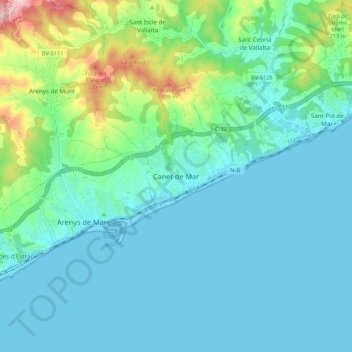
Name: Canet de Mar topographic map, elevation, terrain.

Location: Canet de Mar, Maresme, Barcelona, Cataluña, 08360, España (41.55009 2.53780 41.63009 2.61780)

Average elevation: 72 m

Minimum elevation: -3 m

Maximum elevation: 397 m

Gear up for your next adventure:

🎒Hiking Daypack - Lightweight and durable backpacks for day trips and excursions
🛶Kayak Accessories - Essential gear for safe and fun kayaking adventures
🚲MTB Frame Bag - Carry tools and maps directly on your bicycle frame
🧥Ultralight Puffy Jacket - Maximum warmth that packs down to the size of an orange
🧦Hiking Liner Socks - Thin base layer to prevent friction and blisters

As an Amazon Associate, this site earns from qualifying purchases at no extra cost to you.