
Thank you for supporting this site ❤️
Make a donation
Make a donation
Gear up for your next adventure:
As an Amazon Associate, this site earns from qualifying purchases at no extra cost to you.
Alakuppam topographic map
Click on the map to display elevation.
Thank you for supporting this site ❤️
Make a donation
Make a donation
Gear up for your next adventure:
As an Amazon Associate, this site earns from qualifying purchases at no extra cost to you.
About this map
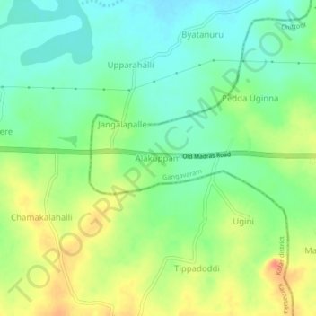
Name: Alakuppam topographic map, elevation, terrain.
Location: Alakuppam, Gangavaram, Chittoor, Andhra Pradesh, India (13.17329 78.53960 13.21329 78.57960)
Average elevation: 731 m
Minimum elevation: 710 m
Maximum elevation: 761 m
Thank you for supporting this site ❤️
Make a donation
Make a donation
Gear up for your next adventure:
As an Amazon Associate, this site earns from qualifying purchases at no extra cost to you.