Geolocate

Seminole topographic map

Click on the map to display elevation.

About this map

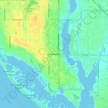
Name: Seminole topographic map, elevation, terrain.

Location: Seminole, Pinellas County, Florida, 33772, United States (27.80009 -82.83112 27.88009 -82.75112)

Average elevation: 8 m

Minimum elevation: -3 m

Maximum elevation: 26 m

Gear up for your next adventure:

🥾Trail Hiking Boots - Supportive boots for rough trails
🧤Thermal Hiking Gloves - Grip-enhanced gloves for cold-weather altitude trekking
🔋Lithium AA Batteries - Long-lasting power that performs in extreme cold
Bushcraft Tarp - Versatile emergency shelter or gear protection
🧢Outdoor Visor - Breathable visor for sunny hikes

As an Amazon Associate, this site earns from qualifying purchases at no extra cost to you.