
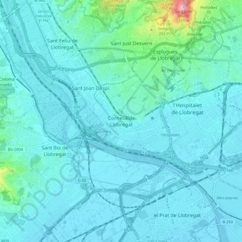
Cornellà de Llobregat topographic map
Interactive map
Click on the map to display elevation.
About this map
Name: Cornellà de Llobregat topographic map, elevation, terrain.
Average elevation: 39 m
Minimum elevation: -2 m
Maximum elevation: 389 m
El relieve es prácticamente llano, oscilando la altitud entre los 67 metros al norte y los 9 metros a orillas del Llobregat. El casco histórico se alza a 27 metros sobre el nivel del mar.